
Georg Gartner
Keynote Title: Maps that Think, Services that Understand: A Cartographic Vision for the Future of Location-Based Services
Abstract: Location-Based Services are rapidly evolving from navigation and information retrieval tools into intelligent systems capable of understanding users, context, and place. Powered by GeoAI, future LBS will not only answer where questions but also support spatial reasoning, explain alternatives, communicate uncertainty, and anticipate user needs. This keynote argues that achieving this vision requires more than advances in artificial intelligence—it requires cartography. By providing principles for abstraction, context, communication, and human-centred design, cartography offers the conceptual foundation for trustworthy, explainable, and adaptive GeoAI. The keynote presents a vision of maps as intelligent interfaces that connect people, places, and AI, enabling the next generation of Location-Based Services to become true spatial intelligence systems.
Biography: Georg Gartner is Full Professor of Cartography at TU Wien (Vienna University of Technology), Austria, and President of the International Cartographic Association (ICA). His research focuses on the conceptual foundations of cartography, Location-Based Services, spatial cognition, and the integration of GeoAI into next-generation spatial intelligence systems. He has authored over 300 scientific publications and has led numerous international research and educational initiatives in cartography. In recognition of his contributions, he has received numerous awards and honours. These include Honorary Doctorates from Eötvös Loránd University (Budapest), the ICA Honorary Fellowship, and an Honorary Professorship from the Chinese Academy of Surveying and Mapping. He serves currently as Vice-Chair of the UN-GGIM Academic Network.

Keynote Speaker
Prof. Georg Gartner
Wenzhong (John) Shi
Keynote Title: Handling Uncertainties in Location-Based Service
Abstract: Reliable location-based services require spatial data that are accurate, current, and fit for purpose. However, uncertainties introduced during data acquisition, integration, analysis, and updating can propagate through the service workflow and affect the reliability of its outputs. This presentation introduces an uncertainty-aware framework that connects mobile mapping, spatial data infrastructure, and location-based services. Mobile mapping systems integrate positioning, imaging, LiDAR, and other sensing technologies to provide high-precision and continuously updateable spatial data. The resulting data are organised within a spatial data infrastructure, where their quality and uncertainties can be assessed, communicated, and controlled before use by location-based applications. The framework is demonstrated through defect detection, Scan-to-BIM, and infrastructure monitoring. These examples show how spatial observations can be linked to detected objects, risks, and service decisions within a consistent reference framework while accounting for uncertainty throughout the workflow. By integrating uncertainty handling from mobile data acquisition to service delivery, the approach supports more reliable, explainable, and safety-aware location-based services.
Biography: Professor John Shi is Academician of International Eurasian Academy of Sciences and Fellow of Academy of Social Sciences (UK), the Director of PolyU-Shenzhen Technology and Innovation Research Institute (Futian), Director of Otto Poon Charitable Foundation Smart Cities Research Institute of PolyU and Chair Professor in Geographic Information Science and Remote Sensing. He earned his doctoral degree from University of Osnabruck in Vechta, Germany in 1994. He is a Fellow of International Society for Photogrammetry and Remote Sensing, Fellow of the Chinese Society for Geodesy, Photogrammetry and Cartography and Hong Kong Institute of Surveyors. Professor Shi also serves as President of International Society for Urban Informatics and Editor-in-Chief of International Journal Urban Informatics.
His research covers urban informatics for smart cities, mobile mapping for autonomous driving and robotics, geographic information science and remote sensing, AI-based object extraction and change detection from satellite imagery, intelligent analytics and quality control for spatial big data. He has published over 350 research articles in journals indexed by Web of Science and 20 books. He is the world’s top 0.27% cited researcher in Geological & Geomatics Engineering according to Stanford World’s Top 2% Scientists. He has over 60 patents granted.
Professor Shi has won State Natural Science Award, China’s highest award for fundamental research, in 2007; Geographic Information Science and Technology Progress Award in 2025; Distinguished Scholar Prize by CPGIS and Smart 50 Awards in 2021; Gold Medal in 2021 & 2023 Geneva Invention Expos; Founder’s Award by International Spatial Accuracy Research Association in 2020; Science and Technology Progress Award in Surveying and Mapping (Grand Award) in 2017; Wang Zhizhuo Award by International Society of Photogrammetry and Remote Sensing in 2012; and ESRI Award for Best Scientific Paper by American Society of Photogrammetry and Remote Sensing in 2006.

Keynote Speaker
Prof. Wenzhong (John) Shi
Ruizhi Chen
Keynote Title: Transforming LBS to Spatial Intelligence by Embodied Navigation
Abstract: Enabled by the rapid development of artificial intelligent technologies, Location-Based Service (LBS) is now transforming to spatial intelligence. Embodied navigation is a key technology powering this transition. This speech will present a few potential localization technologies that will be adopted in a robot platform to form an embodied navigation solution. Furthermore, a cooperative positioning solution engaging with smartphones and robots will be introduced. The speech will be concluded with various applications of spatial intelligence.
Biography: Dr. Ruizhi Chen is Professor of the Chinese University of Hong Kong, Shenzhen. He is a member of the Finnish Academy of Science and Letters. He has developed indoor positioning technologies for smartphones and wearable devices, including the World’s first indoor positioning solution using Electromyography (EMG) sensor; a commercialized technology called Acoustic Positioning System, which has received two rounds of VC investments. He led a team that won the grand challenge in indoor positioning in 2018 organized by NIST in US. His research results were published as cover stories twice in GPS World. He has published 2 books and more than 240 SCI papers cited by 13129 times in Google Scholar with an H-index of 60. He has received 38 Chinese patents and 6 US patents.

Keynote Speaker
Prof. Ruizhi Chen
Stephan Winter
Keynote Title: ‘Location’ in Location-based Services
Abstract: The term 'location' lacks a clear conceptualization both in the broader context of common language and in the domain of technology. In my talk I will line out the parallels to Kuhn’s core concepts of spatial information, discuss these interpretations, and how the term is useful but also limited in these multiple interpretations. I will illustrate the different uses of the term in applications relevant to location-based services.
Biography: Stephan Winter is Professor of Geospatial Information Science at the University of Melbourne’s Department of Infrastructure Engineering. His research applies spatial cognition principles to develop intelligent systems for indoor/outdoor navigation, wayfinding, and transport. He also contributes to engineering education research. He publishes broadly, across geospatial science, computing, and transportation engineering venues. He serves on the ISPRS International Scientific Advisory Committee and steering committees for COSIT and GIScience. He is member of the IEEE ITS Society and ACM SIGSPATIAL

Keynote Speaker
Prof. Stephan Winter
Sunan Jiang
Keynote Title: China’s Scientific and Technological Innovation and International Cooperation
Abstract: This report presents an International Comparison in Science and Technology, focusing on input and output statistics. It then outlines the progress of China's Innovation Development in main fields, followed by an overview of International Cooperation in China's Science, Technology, and Innovation (STI). Furthermore, the report introduces the International Science and Technology Cooperation Initiative proposed by China, and concludes with a summary of key findings
Biography: Mr. JIANG Sunan is the Former Minister Counsellor for Science and Technology, the Chinese Embassy in the UK (2015-2023). He has been dedicated to international sci-tech cooperation, sci-tech and human resource management over the years.From 1994 to 2015, Mr. JIANG worked successively as Second Secretary in the Chinese Embassy in Sweden, Consul (First Secretary) in Chinese Consulate General in Chicago, Consultant in the Department of International Cooperation, Director and then Deputy Director General in the Department of Personnel of the Ministry of Science and Technology of China.He was engaged in business R&D, teaching in university and services for local governments. He holds an MSc in Management from the School of Government, Peking University.
Mr. JIANG has extensive experience in international cooperation. During his years in the UK, he delivered keynote speeches at UK Parliament’s All-Party Parliamentary Groups, UKRI (UK Research and Innovation) and its councils, University of Cambridge, Imperial College London, the London School of Economics and Political Science, as well as events like the Westminster Higher Education Forum, and the Parliamentary Links Day 2021. Additionally, Mr. JIANG was active in facilitating engagement between China and international organizations such as SKA (The Square Kilometre Array).
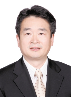
Keynote Speaker
Mr. Sunan Jiang